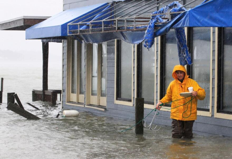
Research from the National Weather Service and the National Hurricane Center shows that about 90% of deaths from tropical systems each year in the U.S. is due to water-related incidents – mostly drowning.
From 1963 to 2012, more than 2,500 Americans were killed by tropical cyclones – with about half of those caused by storm surge.
In other words, flooding from tropical systems is extremely deadly, but it can be hard to forecast where coastal flooding during them will occur – especially on a very local scale.
David Munoz is an assistant professor at Virginia Tech in the Department of Civil and Environmental Engineering. He says there are multiple factors that contribute to flooding when a hurricane approaches a coastal area – sea-level rise, land subsidence, storm surge and heavy rainfall.
“This combination of flood drivers produces an interesting phenomenon called compound flooding where different drivers synergize to produce a greater effect than any of those flood drivers in isolation.”
Right now, Munoz says the National Hurricane Center produces hurricane forecasts five days in advance.
“They produce, for example, the path of the hurricane, the wind, the pressure – all of those parameters that you need to run a hydrodynamic model, a custom model. So, the U.S. has different models in the Gulf Coast and the Atlantic coast. Once you have those forecasts of the forcing conditions – wind, pressure – you can run a model simulation and then forecast the areas that would flood.”

However, he says those models are solving complex physics equations, so…
“It takes a lot of time to simulate that, especially for the Gulf Coast or Atlantic coast – it takes a lot of time and you need supercomputers to do that.”
So, Munoz, graduate student Samuel Daramola and other collaborators at Vrije Universiteit Brussel in Belgium are working on a potential solution – another tool for emergency planners, local governments and disaster response teams that could be life saving.
“So, we trained a model that learns from previous events. So, in our study we focused on hurricanes that hit the Atlantic coast for about 40 years. And what we do is train this model to understand how those different drivers correlate with extreme water levels and [flooding.]”
The deep-learning model – known as a Long Short-Term Memory Station Approximated Model, or LSTM-SAM – tries to identify patterns and examines conditions like wind, pressure, rainfall and wave height. Munoz says the model needs a large sample size so that it can “learn” more about the present conditions to say essentially…
“Ok, in the past, I’ve seen this similar situation, so this is something you will expect. Obviously, you need to validate that to see if it really works. In our study, what we did was basically select some events and then from that we trained the model and then we [used] several other events just to test if we can capture that. And the model worked very good.”
Munoz stresses that traditional forecasting, which utilizes those physics equations I mentioned, will always be important because that will produce the most-accurate forecast. But Munoz hopes the model his team has developed could be a vital tool for forecasters in the years to come.
“We could have kind of hybrid models, where you run the hydrodynamic models and you have those deep-learning models – so the deep-learning model can be a future screening tool that says, ‘Hey, you can expect flooding here.’ And then you can corroborate that with the [other] models.”
The team’s model is quick – producing results in a matter of minutes – and is only going to get better.
“Once the hurricane season passes, what we do is retrain the model because obviously we have more data, and then we can use the model for the next hurricane season as well. The more events you have, the more accurate those forecasts.”
Munoz says the model also features what he calls “transfer learning.”
“What it does is [say], ‘Ok, I’m going to learn information from nearby stations and then if a coastal community in between doesn’t have information, I can just transfer that information to that area and then I can predict that.’”
The team will continue to use the LSTM-SAM framework during this hurricane season – testing it as storms roll in nearly in real time. They also have made its source code available for free so that smaller towns or communities in developing countries have access to the tool where detailed environmental information may not be available.
Thanks for checking out this edition of CommonWx — the weather and climate newsletter from Radio IQ. Use this link to get the newsletter sent to your inbox.


